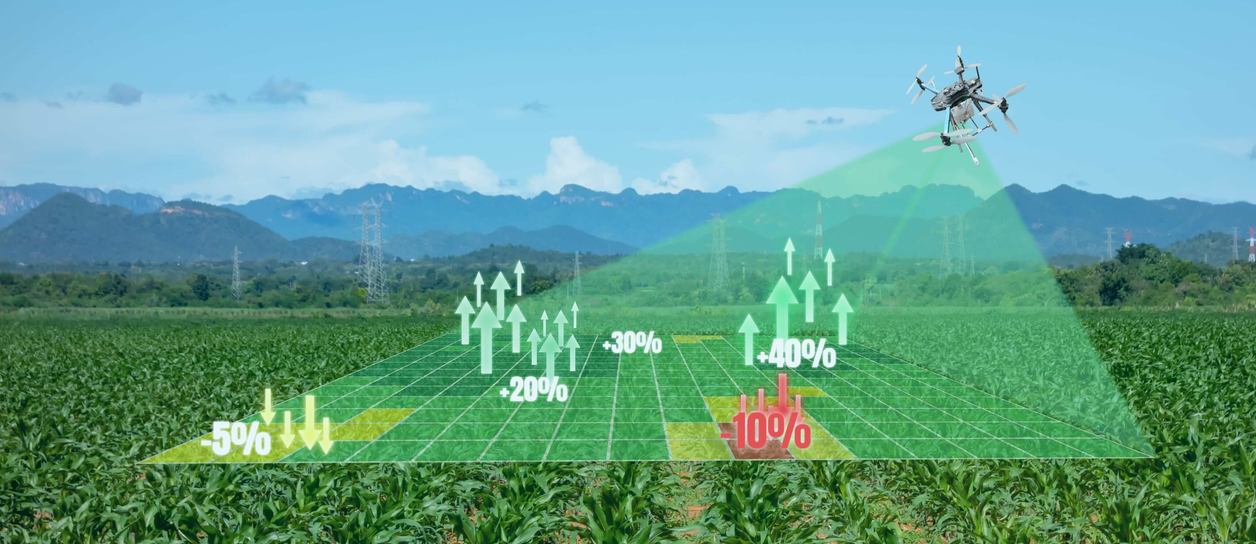
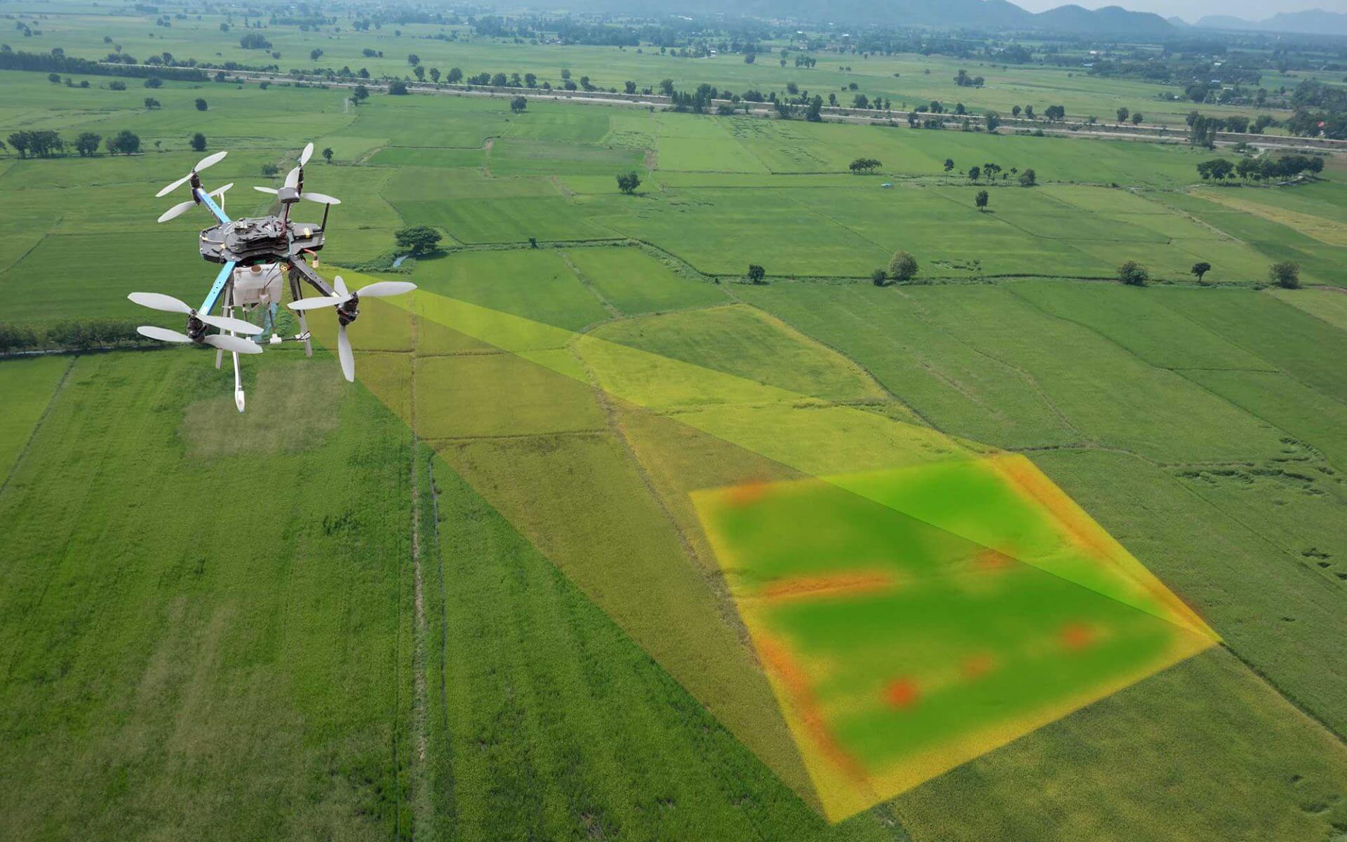
AgriFLY captures more data in less time, allowing researchers understand how different breeds react to certain environments and modify desirable traits in order to improve yield.
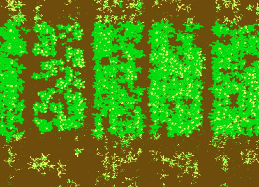
AgriFLY captures high-resolution imagery that specialized software and algorithms can use to classify plants in a given field by size, species, and canopy closure.
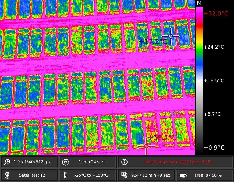
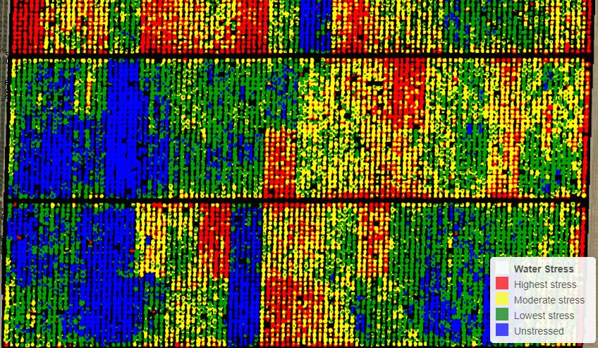
Thermal imagery provides crop stress over time, valuable insights into plant health, since sick plants decrease transpiration and that is reflected into slight temperature changes.
Thermal imagery provides crop stress over time, valuable insights into plant health, since sick plants decrease transpiration and that is reflected into slight temperature changes.
AgriFLY thermal imagery can provide powerful insights into water management, helping identify overspray or missed areas by the difference in crop and soil temperature.
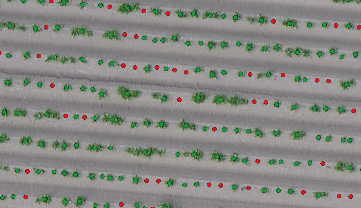
High-resolution multispectral data can feed algorithms information for plant counting, saving farmers hours, and making yield predictions more accurate.
AgriFLY's thermal imagery can help on the identification of irrigation leaks since water has a cooling effect on the vegetation. Areas with excessive irrigation will appear noticeable cooler than the rest of the field.
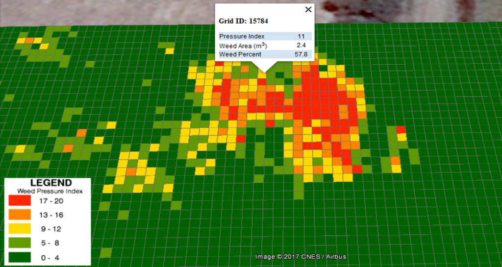
Analytics developed with multispectral data can identify and highlight weeds, as weeds may have a different spectral signature than the planted crop.
AgriFLY not only allows for easy identification of areas low in nutrients but also help monitor the effects of fertilizer applications throughout the season and determine if, when, and where a new application is needed.
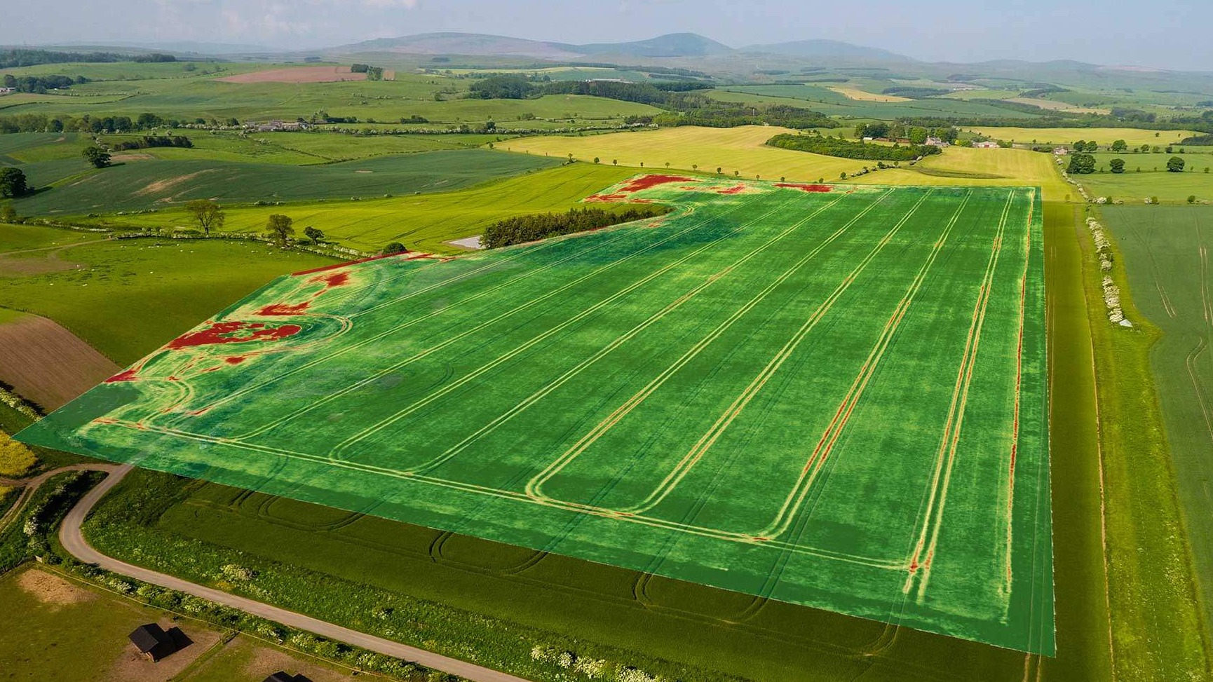
High-quality multispectral imagery provides advanced field scouting capabilities. In one flight, it is possible to collect accurate and geotagged information of a problem, making easy to assess the situation and determine the appropriate intervention.
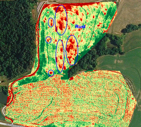
By collecting both multispectral and thermal imagery, Altum can identify diseases before symptoms are visible since the early signs of disease are first apparent in the red edge band and can result in small temperature changes.
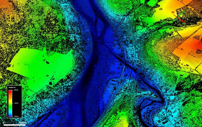
One of the advantages of a calibrated multispectral sensor is the generation of aligned outputs, which can be used to create digital surface models (DSM). A DSM provides insights into water management, land uses and terrain elevation.